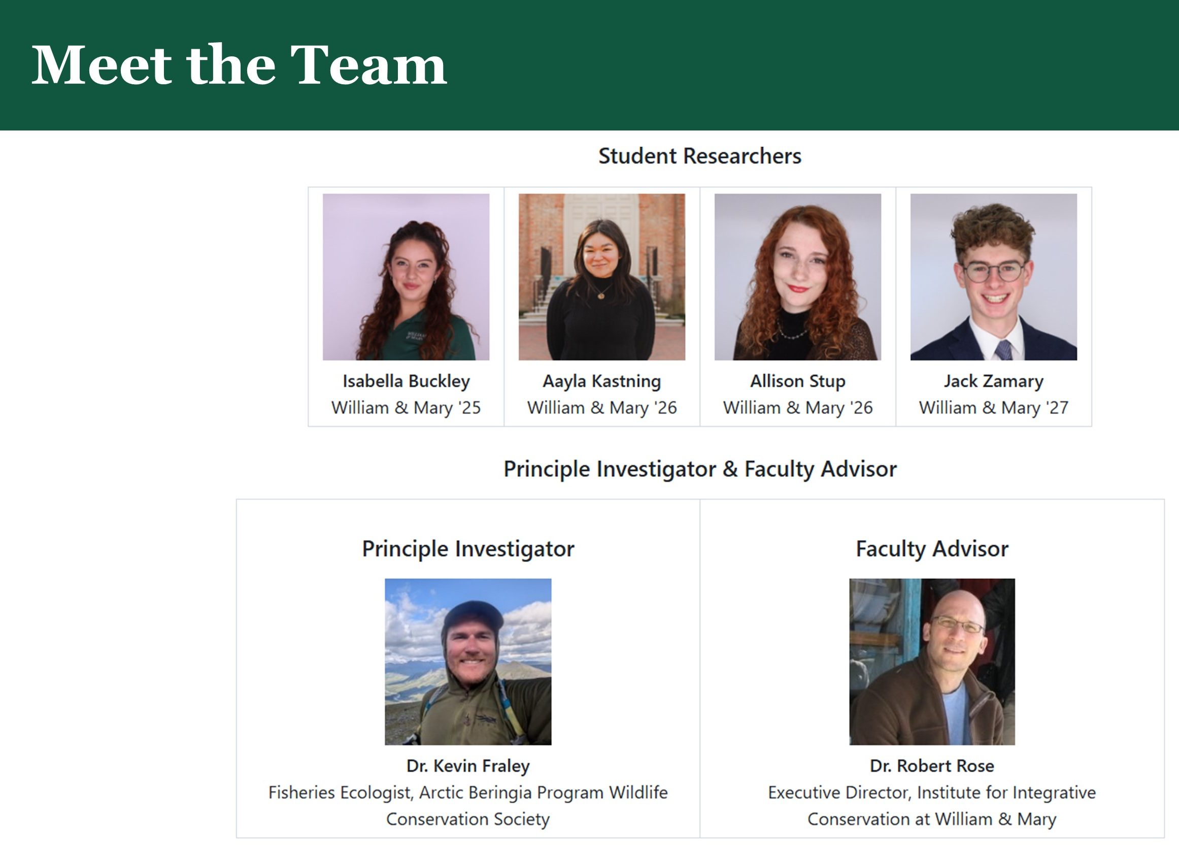
Tracking algal blooms at Krusenstern Lagoon
Authors: Jack Zamary and Allison Stup (College of William and Mary)
Introduction
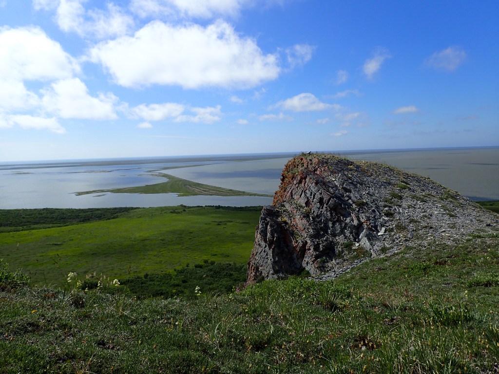
Coastal lagoons are shallow bodies of water separated from the ocean by sandbars, barrier islands, or coral reefs. Along Alaska’s Arctic coast, lagoons in the Chukchi and Beaufort Seas provide critical habitats for a diverse range of fish, birds, and marine mammals, many of which are essential to the food security of local rural and Indigenous communities.
Along the Chukchi Sea, these lagoons connect intermittently to the ocean when ice thaws in the summer or water levels rise above gravel berms. These seasonal connections allow fish to enter the lagoons to feed. Local fishermen are interested in tracking annual and seasonal lagoon dynamics. However, with longer ice-free seasons, it has become increasingly difficult to predict the timing of ice-off, freeze-up, and lagoon connectivity to the ocean to facilitate boat travel to fishing and hunting sites.
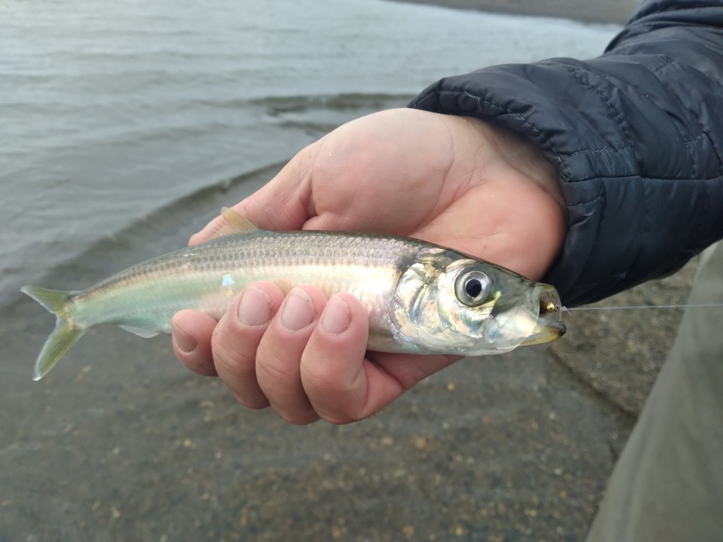
Over the past four decades, northwest Alaska has warmed at nearly four times the global average. These rising water temperatures and increased nutrient availability have led to the emergence of harmful algal blooms in the Chukchi Sea, and potentially in adjacent coastal habitats. Given the accelerated rate of warming in the Arctic Beringia region relative to the global average, monitoring ecological and temporal changes is crucial for informing local communities and conservation efforts. As indicated by local knowledge, such events, previously rare in the Arctic, have been occurring more frequently since 2008. These blooms can produce harmful toxins that can be transferred through the food chain, potentially affecting invertebrates, fish, and other biota that are of subsistence harvest importance to Alaska Native and other rural residents. While algal blooms have been studied in the Chukchi Sea proper and in Kotzebue Sound, they have not been assessed in the multitude of coastal lagoons inhabited by planktivorous Pacific herring and least cisco, both of which are highly valued by local fishers.
To better understand these changes, Aayla Kastning, Isabella Buckley, Jack Zamary, and Allison Stup, students at The College of William & Mary’s Institute for Integrative Conservation, collaborated with Dr. Kevin Fraley, Fish Ecologist for the Wildlife Conservation Society’s Arctic Beringia Program, to investigate the spatial and temporal dynamics of algal blooms in Krusenstern Lagoon, Cape Krusenstern National Monument, Alaska, over four academic semesters (Fall 2024 to Spring 2026). The students undertook the work while enrolled in the Conservation GIS Lab at William & Mary, led by Professor Robert Rose and Professor Sapana Lohani. This program provides undergraduates with opportunities to work on real-world conservation challenges at the forefront of transformational research and education, with a network of conservation partners.
Methodology
Overview/Project Objectives
The research conducted over the past three academic semesters has focused on comparing field samples from Krusenstern Lagoon, located in Krusenstern National Monument, Alaska, to satellite-derived values of the normalized difference chlorophyll index (NDCI). The objective was to examine the correlation between field samples and satellite imagery to observe if a positive relationship existed, with the goal of increasing monitoring capability of bloom events along the Chukchi Sea coast.

Algal bloom events occur when cyanobacteria, commonly known as blue-green algae, multiply rapidly, often fueled by excess nutrients, warmer water temperatures, and increased sunlight. These blooms can produce cyanotoxins, which may harm people, fish, shellfish, marine mammals, and birds. Monitoring algal blooms is therefore an important part of understanding how changing environmental conditions are affecting Alaskan ecosystems. In regions such as Krusenstern Lagoon, where in-person sampling can be difficult due to remoteness and seasonal access limitations, satellite imagery provides a valuable tool for tracking bloom severity, identifying areas of concern, and supporting long-term ecological monitoring of the region. The research aimed to improve understanding of bloom dynamics over the last decade, define an index for classifying bloom severity in coastal lagoons, and monitor seasonal changes to inform stakeholders in northwest Alaska.
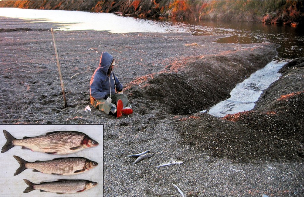
Field Sample Collection
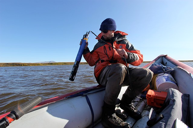
Field samples were collected at Krusenstern Lagoon from 2017 to 2024 across nine locations spaced throughout key areas of interest, including the inlet, outlet, and lagoon center. From 2017 to 2018, turbidity, chlorophyll, and blue-green algae (BGA) were recorded in micrograms per liter (µg/L), while samples collected from 2018 onward were recorded in Formazine Nephelometric Units (FNU). Because there is no direct universal conversion between these units, the values were not converted. No field data were collected in 2019 or 2020 due to access limitations. As a result, field samples from 2021 onward were used for comparison with Sentinel-2 satellite imagery.
Satellite Imagery Collection
Sentinel-2 images were collected using the Google Earth Engine (GEE) application programming interface (API) within a Jupyter notebook. The image collection set chosen was the Harmonized Sentinel-2 MSI: MultiSpectral Instrument, Level-2A (SR). This specific dataset was chosen from the Earth Engine Data Catalog, as SR datasets include atmospheric correction, cloud/shadow masking, and bidirectional reflectance distribution function normalization, making them ready for analysis without extensive preprocessing needed. Sentinel-2 was chosen in particular over other mainstream satellite options (Landsat, Planet) for its 5-day revisit period and access to the red edge band (B5, central wavelength = 705nm) that is necessary when computing the NDCI.
Data Preparation and Analysis
To effectively clip the lagoon of interest, a feature class for Krusenstern was created in ArcGIS Pro, where the lagoon was drawn as a polygon. This file was imported in GeoJSON format and used to create a feature collection for use with GEE. A cloudy cover percentage of 30 was applied, and a projection of WGS-84 was used in compliance with GEE’s projection standards. Necessary steps in data preprocessing were taken to create a comprehensive data frame of sampling locations and their values.
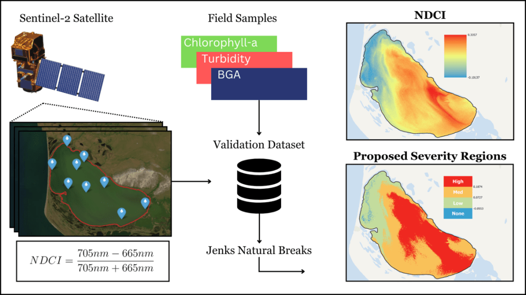
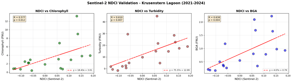
To compare field samples and satellite-derived values, a 20m buffer was placed around each field collection point to account for discrepancies in GPS collections, wind, tide, and similar environmental factors. A mean reducer was used to calculate the mean NDCI value within the buffer. Five field collection dates were found to have overlapping satellite imagery with low cloud cover. NDCI values for these dates were collected and compared to chlorophyll, turbidity, and blue-green algae (BGA) values recorded in the field. The strongest positive correlation was found between BGA field samples and the Sentinel-2-derived NDCI (R = 0.638, p = 0.004). This validation across five temporally matched field-satellite pairs confirmed NDCI as a reliable proxy for algal bloom detection in Krusenstern. Furthermore, this correlation allowed for the development of a proxy index to classify any remote-sensed image of Krusenstern lagoon and visualize possible algal blooms, provided the images had low cloud cover.
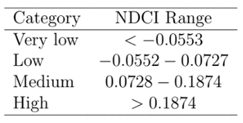
Using a Jenks natural break classification, data were partitioned into four groups: none, low, medium, and high in relation to the severity of algal blooms. This partition acted as a classification schema for determining bloom severity in Krusenstern Lagoon for future dates. With a classification schema and validation dataset in place, Sentinel-2 data were collected from 2019 to 2025 and classified to create time series that represent temporal changes.
Results
Evaluation of trends over time indicated that bloom levels have remained consistent over the past seven years, with 30.38% of Krusenstern Lagoon affected by moderate algal blooms during peak summer months (June, July, and August). It is unknown if these blooms represent algal taxa that produce toxins or if bloom intensity has been significant enough to affect planktivorous fish, which inhabit the lagoon and graze on zooplankton that potentially take up algal-derived toxins. The ingestion of algal-derived toxins can affect the growth, reproduction, and survival of aquatic organisms, with the potential for cascading effects throughout the lagoon food web and impacts on communities that rely on subsistence fishing.

Success of Remote Sensing Data
This initial research makes incredible use of open-source satellite imagery from the European Space Agency’s Sentinel-2 Satellite. For most of the months of interest, the Earth Engine dataset with a revisit time of 5 days provided substantial data for performing time series analysis using the proxy index. The approach and data collection were successful, following the many other studies in the conservation field that have begun leveraging remote sensing over the past decade to answer difficult questions.
Changes in Bloom Severity
Some analysis was conducted to determine whether there has been a statistically significant increase in bloom severity during the six-year period from 2019 to 2025. Unfortunately, it quickly became evident that bloom levels have largely remained consistent over the years, and any small trends were influenced by outliers (e.g., August 2024). More data preceding 2019 and from the coming years is needed to draw conclusions regarding specific trends in Krusenstern Lagoon.
Jenks Natural Breaks Classification
The resulting Jenks natural break classification partitioned data into four unique groups by identifying natural clusters, a technique commonly used in GIS. This method was useful for translating continuous NDCI values into bloom severity categories, ranging from no/low bloom to high-bloom conditions. The output categories were useful in classifying imagery and identifying spatial patterns in bloom intensity across Krusenstern Lagoon.
that were plotted against sentinel-2 values
The final class separation did a good job capturing the overall trend in the NDCI across Krusenstern Lagoon. The index also allowed for the evaluation of all cloud-free satellite images collected in the target months. Further data collection in the field will help to better validate this proxy index for use on bloom classification within other coastal lagoons.
Discussion
This initial research highlights the current status of algal blooms in an Arctic coastal lagoon and the importance of continued monitoring. For the years that Sentinel-2 imagery is available, it is clear that algal blooms are common during July and August at Krusenstern Lagoon, but bloom intensity does not appear to be increasing over years. The low sample size of field samples that aligned with satellite collection days and turbid water conditions posed a challenge for this initial assessment of bloom impact. However, the team plans to continue compiling remotely sensed bloom data and will return to Krusenstern Lagoon in the future to continue water measurements to improve the power of inference. Finally, assessments of lagoon invertebrate and fish samples for cyanotoxin concentration will be prioritized to assess possible effects of algal blooms on the aquatic food chain and identify any concerns for subsistence fishers.
Challenges
While this research provides initial insights into the temporal characteristics of algal blooms in Krusenstern Lagoon and has developed a replicable index to classify potential bloom regions from Sentinel-2 imagery of the region, the low sample size and high correlation to turbidity complicate the results.
Temporal resolution of the Sentinel-2 satellite posed the most difficulties. Due to high cloud coverage in the Arctic region, finding field collection days that overlapped with Sentinel-2 collection days was rare. Out of ten total sampling days between 2021 and 2024, only half of those days had eligible satellite coverage. This meant only 14 total values could be collected and compared. Working with a sample size well below 30 means there is an increase in vulnerability to outliers, random variation, and sampling bias, making results less representative and harder to generalize to broader representations.
The low sample size of this initial study directly affects the bounds for the proposed severity regions. While the regions generally capture the NDCI values, because of the low sample size and the effects of the Jenks natural breaks classifier, values of both low and high severity are slightly misrepresented. Based on the proposed framework visual from the methods section, areas of high severity should be much fewer and areas of low severity should be greater. Future sampling of Krusenstern lagoon will help to provide more data and better validate the current classification schema. It’s important to note the correlation between turbidity and collected field samples. While the R-value for turbidity was not as strong as that for BGA, it still presents a weak-to-moderate correlation within the data. This result is ambiguous, as it could indicate that turbid water conditions are being misclassified as algal blooms in some cases. Turbidity levels do increase during bloom events.
Future Work
Data collection and analyses of algal blooms will continue for Krusenstern Lagoon to examine and monitor any trends over years and identify any points of concern for local fishers. Along with gathering more field samples, looking into some of the region’s climate variables (temperature, precipitation, etc.) could lead to the creation of features to train a machine learning model to predict blooms. For a machine learning model, climate variables could be used to predict bloom events in a classification model.
Conclusions
The results from the past three semesters of work have indicated the usefulness of using open-source satellite imagery to monitor bloom events in Krusenstern Lagoon. The provided framework will help researchers better monitor bloom events and inform conservation-related decisions in the Arctic. Furthermore, this initial research allows for the foundation of continued sampling in Krusenstern Lagoon to further build out the validation dataset and achieve a better aligned proxy index.
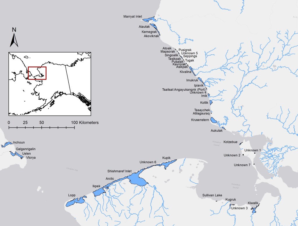
Future work should focus on expanding the number of paired field and satellite observations, refining severity thresholds, and applying the framework to additional coastal lagoons across the study region. Some other notable lagoons of interest include Kupik, Ikpek, and Kotlik. Together, these efforts can improve long-term monitoring of harmful algal blooms and provide valuable insights into how changing environmental conditions are affecting the coastal Arctic Beringia region.
Acknowledgements
Institute for Integrative Conservation
This project has provided multiple William & Mary undergraduates with the opportunity to work on solving real-world conservation challenges as part of the Conservation GIS Lab on campus, led by Professor Robert Rose and Professor Spana Lohani. Opportunities such as this one have been made possible by the university’s Institute for Integrative Conservation, which works at the forefront of transformational research and education aimed at solving critical conservation issues in partnership with a network of conservation partners.
Wildlife Conservation Society
The opportunity to work with Dr. Kevin Fraley over the past two years has been an invaluable experience for all the students who have participated in the research lab. Working alongside Dr. Fraley has allowed students to learn more about Alaska’s ecosystem, algal blooms, and the importance of conservation efforts in the Arctic Beringia region.