US Bureau of Land Management Activities
For over a decade, the BLM has been actively restoring stream habitats degraded by historic mining practices, while also improving reclamation techniques for active placer mining operations. In recent years, restoration has incorporated a range of methods—from intensive interventions using heavy equipment to low-tech, hand-built structures & revegetation techniques meant to accelerate the rate of natural recovery. This includes several sites within the Yukon River drainage that currently or historically provided salmon habitat.
A central focus of this work has been monitoring the effectiveness of these varied approaches. Gaining a clear understanding of which techniques perform best in Alaska’s harsh environment is critical—not only for the successful restoration of historically impacted watersheds, but also for ensuring that stream reclamation efforts are both effective and sustainable. More information about BLM’s restoration efforts is available on our website: Gravel to Gravel | Bureau of Land Management .
This season more restoration progress was made on Wade, Nome, and Gold Creek using well-established techniques as well as some new approaches. The work in Wade and Nome Creek was completed with partners such as the Salcha-Delta Soil and Water Conservation District, American Conservation Experience, and Trout Unlimited. BLM also hosted a tour and two volunteer events to the public to get hands-on experience with low-tech restoration methods. Work completed in Gold Creek was accomplished collaboratively with BLM Central Yukon field staff and a gold miner on their claim. The following work highlights 2025 accomplishments for BLM and partners.
Wade Creek
BLM continues to conduct habitat work within the Wade Creek watershed and expand outreach to visitors traveling the Taylor Highway. This season new floodplain habitats were created along 1,200 ft of stream where mine tailings previously confined the creek. Additionally, improvements to several culvert outflows were made in cooperation with the Alaska Department of Transportation.
Nome Creek
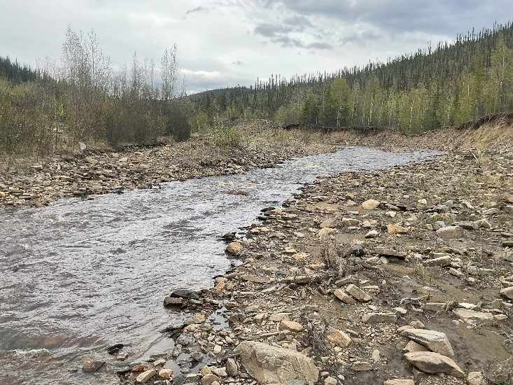
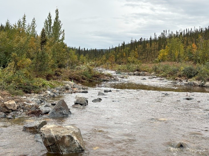
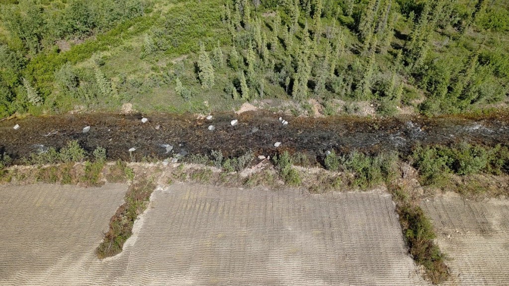
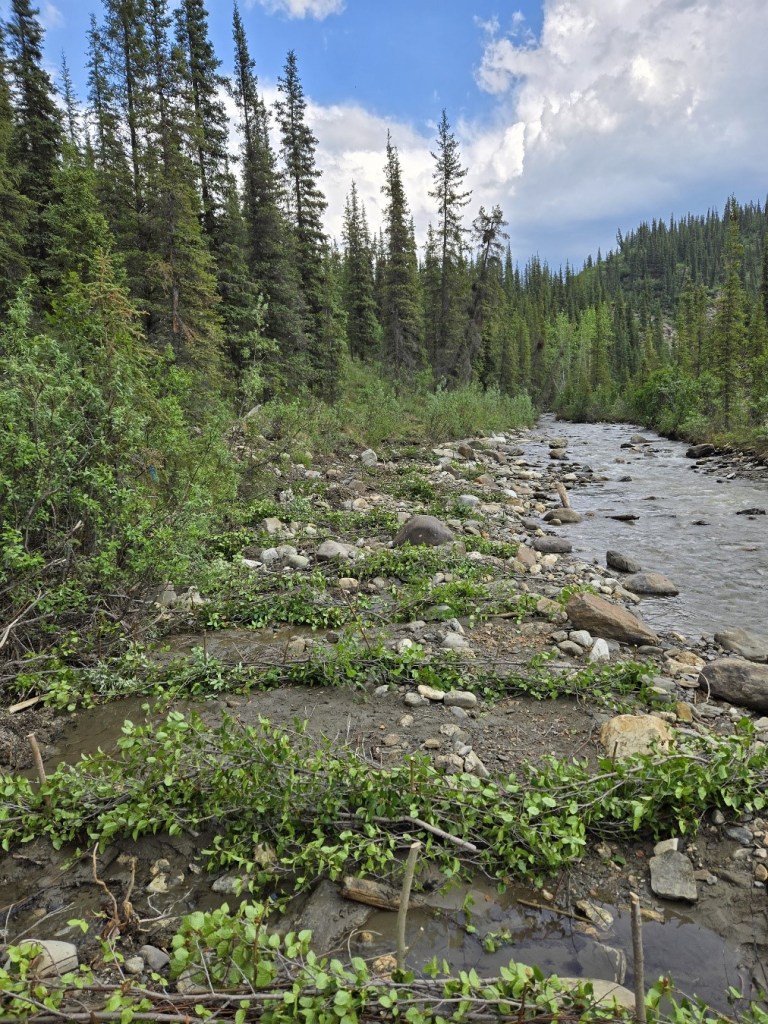
An 8-mile stretch of Nome Creek has been the focus of restoration efforts since the 1990s, with recent work targeting areas still impacted by legacy mining. This summer, the BLM employed multiple restoration tools and techniques to address persistent habitat degradation.
A major component involved removing extensive mine tailings to allow the creek to reconnect with its floodplain—restoring natural sediment deposition processes and helping to recharge groundwater. To further enhance floodplain function and create off-channel habitat for fish and wildlife, two pond features were constructed with outlet streams flowing into Nome Creek. Excavated materials were carefully sorted to recover organic matter and fine sediments, which were then applied to barren floodplain areas to promote revegetation. Despite the passage of decades since mining ceased, large portions of the Nome Creek valley bottom remain sparsely vegetated due to poor soil conditions and rocky substrates. The BLM hopes that the addition of fine sediments to these areas will help jump start the recovery of vegetation.
To improve in-stream habitat complexity, several thousand feet of stream channel were enhanced with the addition of large wood and boulders—features that provide critical resting areas for fish and increase overall habitat diversity. In a few areas, instream structures were added to provide deep pool habitats and to prevent channel incision.
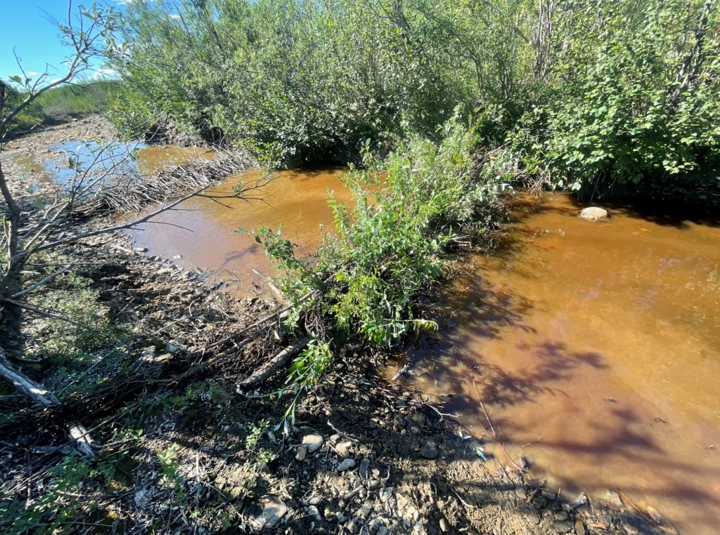
Beaver Dam Analogs

Beavers are known to be “ecosystem engineers” because their dam-building creates wetlands that slows water flow, retains sediments and nutrients, and changes landscapes. Their activity provides important benefits by reducing erosion and flooding, storing water, and creating habitats for other species.
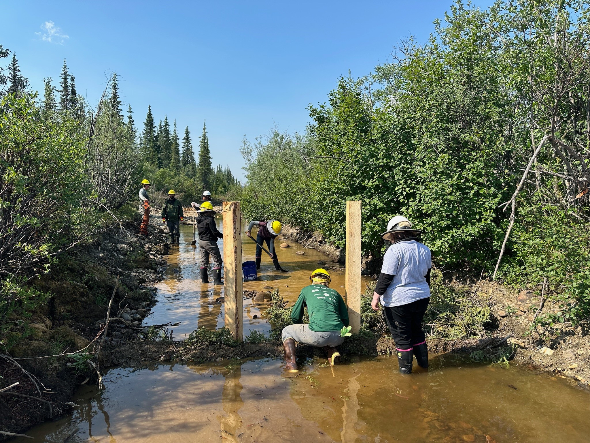
BLM built structures similar to beaver dams, to help restore habitat in the White Mountains National Recreation Area that was impacted from gold dredge operations that altered waterways to sort gold from gravel. The structures, called “beaver dam analogs,” mimic the function and benefit of natural beaver dams and are easily built by hand using locally harvested materials such as wood, rock, mud, and live willow branches.
This year, BLM continued building beaver dam analogs in a side channel of Nome Creek. The hand-made dams have helped to raise the water level of a pond that supports growth of nearby vegetation and creates refuge habitat for resident fishes, such as Arctic grayling.
Revegetation
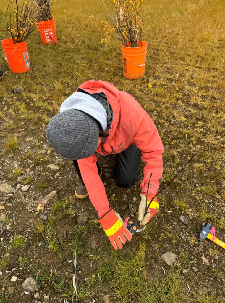
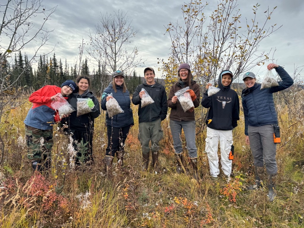
In celebration of National Public Lands Day, the BLM worked with volunteers to help improve the health of public lands in the White Mountains National Recreation Area. The team worked together to contribute to revegetation efforts in parts of Nome Creek where BLM has been working to improve fish and aquatic habitat for the headwaters of the Yukon River.
Together, BLM and volunteers planted over 100 willow stakes along the creek. Willows are resilient native plants that help hold stream banks together to prevent erosion, provide shade and homes for insects in riparian areas, and serve as food for beneficial animals such as beaver and moose. The willow stakes and revegetation areas will be monitored for years to come, so we may learn more about revegetation techniques for sub-arctic conditions.
In addition, native plant seeds were collected nearby and spread into the revegetation areas to foster natural plant growth and to keep out non-native plants that often take hold in disturbed soils.
Volunteer time and energy makes a real difference in caring for public lands. For more information on how to volunteer to help with future projects, please email rlane@blm.gov.
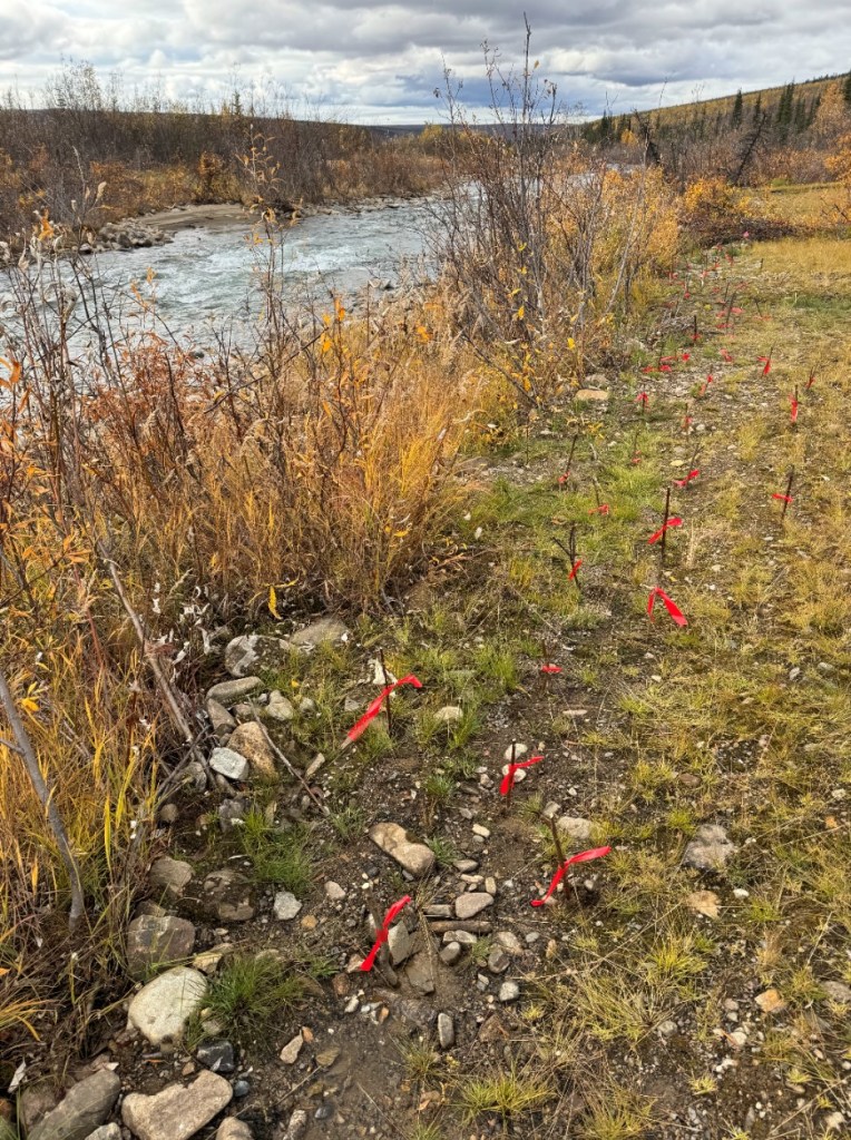
Gold Creek
Central Yukon Field Office staff joined a gold miner to help enhance the reclamation on his placer claim along Gold Creek north of Wiseman, Alaska. The goal was to encourage riparian revegetation following placer mining by staking willows, installing willow weaves, and planting riparian species seedlings to trap fine sediments on the floodplain bench. Revegetation of the floodplain bench following placer mining promotes stream stability, reduces erosion, and rehabilitates habitat.
BLM staff worked with the miner to enhance the vegetation on the floodplain by building willow weaves, planting willow stakes, and transplanting Alpine sweetvetch (Hedysarum alpinum).
Willow weaves are a simple reclamation tool used to trap sediment on the floodplain bench and foster regrowth of vegetation.
Willow stakes will sprout roots and grow into a willow plant, aiding in riparian area revegetation. Fourteen willow weaves were installed in the rocky area. Each weave had willow stakes spaced about two feet apart with alder, willow, and some dead spruce branches weaved between.
Plugs of Alpine sweetvetch were transplanted between willow weaves and in the disturbed, rocky uplands. Alpine sweetvetch is commonly used in revegetation projects throughout Alaska. It fixes nitrogen and thrives on sandy river shores and gravel bars, among other habitats, making it an excellent species for revegetating nutrient-poor placer-mined sites that lack organic matter and fine-textured soil particles.
Over the next few years, BLM will monitor the reclamation site and the success of the willow weaves, willow stakes, and transplants. A late fall visit of Gold Creek indicated that most of the willow weaves survived a major flood event and many of the willow stakes showed signs of new growth!
We will continue to use these basic, but effective methods to support revegetation, applying lessons learned from the Gold Creek and other sites to optimize reclamation efforts. BLM will continue working with miners, building relationships, transferring knowledge, and sharing techniques to improve revegetation of mine sites.
“AIM” Surveys
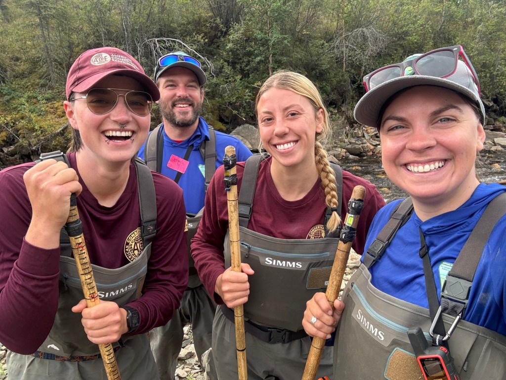
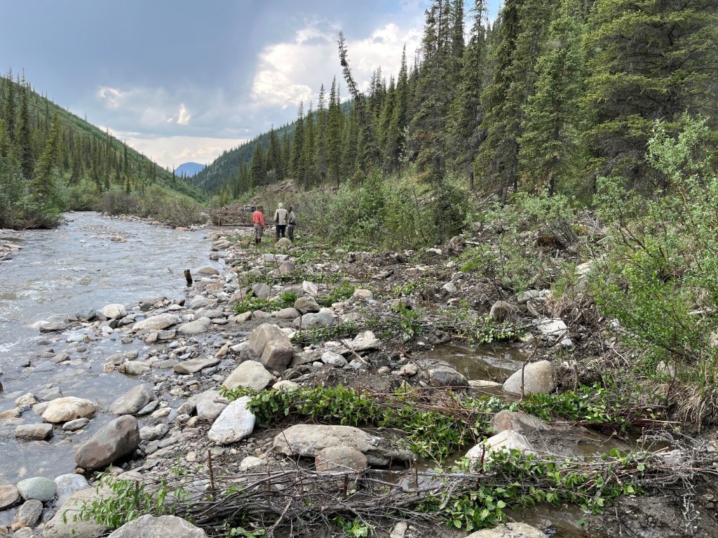
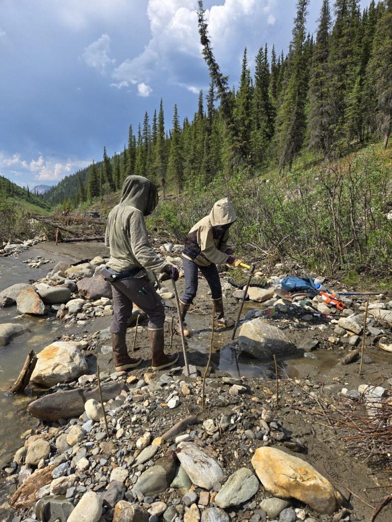
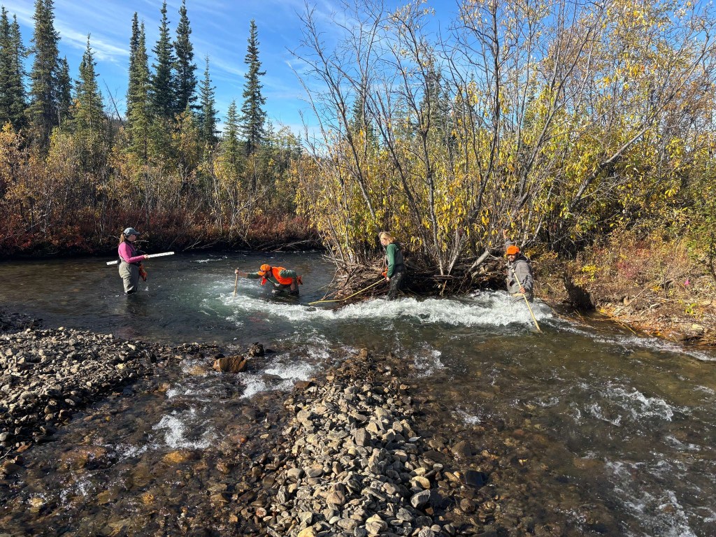
BLM staff and interns with American Conservation Experience (ACE) spent the last two summers wading in Yukon River headwater streams to collect data at sites where BLM is working to rehabilitate streams and improve aquatic habitats that will benefit salmon and many other species.
Crews collected data before and after stream rehabilitation work to track changes in habitat conditions for fish and other species using the BLM’s Assessment, Inventory, and Monitoring (AIM) data collection techniques. BLM uses this information to measure changes in habitat conditions for fish and other species. Following AIM techniques, the crews measured stream and floodplain characteristics such as width, slope, and depth of the channel, pool characteristics, streambank stability, and vegetation cover and complexity. The data are used to monitor changes from rehabilitation efforts and help inform other land management decisions.
The BLM Assessment, Inventory, and Monitoring (AIM) monitoring program uses standardized field sampling techniques, electronic data capture, and appropriate sample designs to monitor conditions of natural resources on BLM lands throughout the United States. There are 3 main types of AIM – Terrestrial, Lotic, and Riparian & Wetland. The word “lotic” describes organisms or habitats located in moving, freshwater streams, so if you saw crews working in the streams the last two summers, they were conducting Lotic AIM. To learn more about BLM’s Assessment, Inventory, and Monitoring (AIM) program, visit: http://www.blm.gov/aim.
As many of you have experienced while enjoying Alaska’s outdoors, the AIM crews encountered heavy rain, snow in August, smoke from nearby wildfires, bears, and an abundant brood of mosquitos and gnats. Their summer highlights included working with excellent partners, exploring new places in Interior Alaska, learning and applying different restoration techniques, and camping. Look for the crews again conducting AIM in 2026!
Questions or comments on this work? Please contact mvarner@blm.gov or ejmay@blm.gov
